GSA Spatial Data Management Contract
Nationwide
 |  |  |
|---|---|---|
 |  |  |
 |  |  |
 |  |  |
 |  |  |
 |  |  |
 |  |  |
 |  |  |
 |  |  |
 |  |  |
 |  |  |
 |  |  |
 |  |  |
 |  |  |
 |  |  |
 |  |  |
 |  |  |
 |
The Spatial Data Management (SDM) program is an endeavor by the General Services Administration (GSA) to capture and maintain information about our federally owned building space. The GSA owns and leases over 376.9 million square feet of space in 9,600 buildings in more than 2,200 communities nationwide. The SDM program helps the GSA identify the most efficient and cost-effective way to house federal employees and assists the billing department in providing accurate rent estimates and bills to each tenant agency. It uses SDM Computer Aided Design floor plans as the basis for assignment data and also identifies non-revenue producing and vacant space to improve usage.
PDG Architects has been providing Spatial Data Management (SDM) services to the GSA nationally since 1993. Over these numerous years, we have worked side by side with the GSA personnel to develop a maintenance procedure to keep their building inventory up to date and their data current. We can state, with pride, that we have the same core staff serving the GSA since our first contract in 1993.
Our SDM management staff has an unsurpassed level of experience in GSA Base and Assignment production and As-built Documentation. Our cumulative knowledge of GSA’s building construction, ANSI/BOMA, AutoCAD, Revit, eSMART, REXUS, and PBS space classification per the NBSAP is the most extensive in the nation.
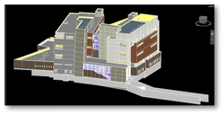
PDG has completed highly accurate As-Built Documentation of over 2,000 as-built projects of federal facilities nationwide, totaling in excess of 200,000,000 square feet. Over the past 10 years, we have been testing the use of different Laser Scanning and 3D imaging technologies. During that same time period, we have studied Base BIM Modeling with the production of more than 50 building models totaling in excess of 8 million square feet. In the last 3 years, PDG has integrated to the use of 3D point cloud data obtained through the use of a hand held laser scanner, capturing more than 1,000 scan worlds that have been passed to GSA during the production of all of our as-built projects. GSA has now a collection of fieldwork and laser scans that can be used and leveraged throughout all aspects renovation/alteration projects as well as facility management.
